20 STONE RIDGE RD
Owner Information
AARON DANIEL + DUPUIS CAROLYN
20 STONE RIDGE RD
N ATTLEBORO, MA 02760


Property Details
20 STONE RIDGE RD is classified as a Single Family Residential (Colonial).
The primary structure on this property was built in 1992. There are 11,199ft2 of built area within this property. There is 4,707ft2 of residential/living space within this property. This property is listed as having 8 rooms.
20 STONE RIDGE RD is valued at $878,900. The land is valued at $193,600 and the structures are valued at $677,700. There is an additional valuation of $7,600 on this property.
The most recent deed for 20 STONE RIDGE RD is recorded at the local registrar in Book 23317, Page 0215. 20 STONE RIDGE RD was last sold on Friday, October 14, 2016 for $940,000.
Assessment data from fiscal year 2022.
Flood Data
According to the FEMA National Flood Hazard Layer, this property does not appear to be in a flood zone. It may also be in an area not yet reviewed. Nonetheless, confirm this information prior to taking any action.
To view the flood hazards around this property, create a FEMA "Firmette" Map of the area around 20 STONE RIDGE RD.
Broadband Internet Providers
| Provider | Type | Bandwidth (mbps) | |
|---|---|---|---|
| Viasat Inc | Satellite | 100 | 3 |
| GCI Communication Corp. | Satellite | 0 | 0 |
| Comcast | Cable | 1000 | 35 |
| VSAT Systems, LLC. | Satellite | 2 | 1 |
| HughesNet | Satellite | 25 | 3 |
| Verizon New England Inc. | Fiber | 940 | 880 |
| Verizon New England Inc. | DSL | 3 | 0 |
Broadband service provider data from December 2020.
Adjacent Properties
- 34 STONE RIDGE RD
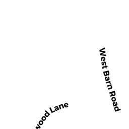
Single Family Residential owned by CONNAUGHTON J KEVIN + SUSAN LIBBY TRS - 100 WEST BARN RD
Single Family Residential owned by DEVINE JAMES E III + JUDI R - 12 RUSTWOOD LN
Developable Residential Land owned by AARON DANIEL + DUPUIS CAROLYN - 32 RUSTWOOD LN
Single Family Residential owned by PAQUETTE THOMAS JR + SARAH-ANNE - 829 PAINE RD
Single Family Residential owned by ABUSHEERY GREG A - 817 PAINE RD
Single Family Residential owned by COURTOIS DAVID N + ALLEN JANET